Poster: UN Mappers
UN Mappers: a thriving community to support Peace and serve Humanity
Unite Maps Initiative formerly named United Nations Dynamic TLM (Topographic Line Map) Production, is a mapping initiative to collaborate in peacekeeping, peacebuilding and conflict prevention activities. United Nations helps countries torn by conflict create conditions for lasting peace through the Department of Peacekeeping Operations (DPKO):w .
There is enormous potential for new technologies to improve the effectiveness of UN Peacekeeping missions, as they respond to an ever-growing list of tasks in increasingly complex field environments.
The United Nations Dynamic TLM MAP Production project started at the end of 2018.
This has been promoted by Service for Geospatial, Information and Telecommunications Technologies (SGITT) of the United Nations Global Service Center (UNGSC) which supports Peacekeeping operations. The SGITT is the operational hub at UNGSC for the support and delivery of ICT services and solutions to field operations. The Project set a new standard in the UNGSC and wants to be a starting point for tight collaboration between UN and all the humanitarian agencies.
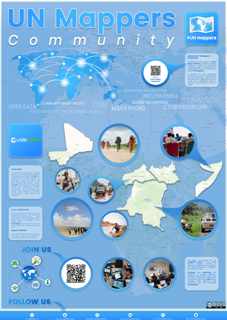
Unite Maps Initiative contributes to the creation of topographic and operational maps to UN Peacekeeping missions editing geographic data on OSM both with an internal mapping facility and crowdsourcing activities. In order to achieve its goals, the Unite Maps Initiative is building a thriving community around the collection, validation, usage, and dissemination of geospatial data. This community is called UN Mappers.
It benefits from the established crowdsourcing and collaborative initiatives which are providing a more accurate and dense set of geospatial data for further use in topographic, urban or thematic maps both online and on paper. The mapping activity involved 3 countries from 2019 (Somalia, Democratic Repubblic of the Congo, Central African Repubblic) and will additionally involve in 2020 Mali, South Sudan and Abyei.
The UN Mappers are a diversified and steadily growing community of mappers, ranging from UN GIS, military and police personnel, to academia (highschools and universities), from local communities to any remote volunteer, that would like to bring their help to support peace and serve humanity. At the moment of writing (30/06/2020) the UN Mappers community is composed by more than 450 contributors as shown in our dedicated UN Mappers Leaderboard. Unite Maps Initiative is organizing trainings with UN Peacekeeping missions personnel, engagement and capacity building with local communities, mapathons with students in schools.
Among all these activites, they have been opened many OSM Tasking Manager projects and an import of waterways data in Somalia, with operational data coming from the UNSOS mission. Furthermore editing guidelines have been written to help contributors in Somalia, Democratic Repubblic of the Congo and Central African Republic.
If you would like to be part of UN Mappers, as a mapper or as an organization, feel free to drop us a mail at un.mappers@un.org or follow our activities through our social media accounts: